Geolocate

Lanas topographic map

Click on the map to display elevation.

About this map
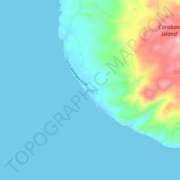
Name: Lanas topographic map, elevation, terrain.

Location: Lanas, San Jose, Romblon, Mimaropa, 5510, Philippines (12.03057 121.89819 12.07057 121.93819)

Average elevation: 35 m

Minimum elevation: 0 m

Maximum elevation: 197 m

Gear up for your next adventure:

🎨Portable Watercolor Kits - Paint the landscapes and topographic views you discover
🥾Hiking Shoes - Lightweight hiking shoes for day hikes
🧼Biodegradable Outdoor Soap - Clean gear and yourself without harming the local ecosystem
🧭Compass - Navigation compasses for outdoor exploration
🎒Dry Bags - Waterproof bags for outdoor gear

As an Amazon Associate, this site earns from qualifying purchases at no extra cost to you.