Harrison topographic map
Interactive map
Click on the map to display elevation.
About this map
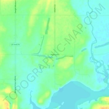
Name: Harrison topographic map, elevation, terrain.
Location: Harrison, Sequoyah County, Oklahoma, United States (35.40009 -94.88745 35.44009 -94.84745)
Average elevation: 150 m
Minimum elevation: 140 m
Maximum elevation: 170 m
Other topographic maps
Click on a map to view its topography, its elevation and its terrain.
Aqua Park
United States > Oklahoma > Sequoyah County > Paradise Hill
Aqua Park, Paradise Hill, Sequoyah County, Oklahoma, United States
Average elevation: 235 m
Andes Mountain
United States > Oklahoma > Sequoyah County
Andes Mountain, Sequoyah County, Oklahoma, 74945, United States
Average elevation: 202 m