Geolocate

Baqa topographic map

Click on the map to display elevation.

About this map
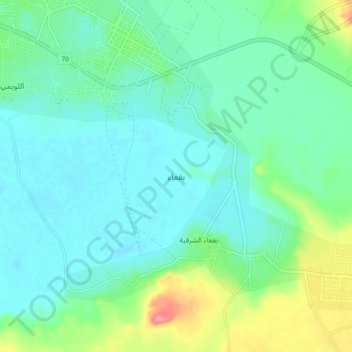
Name: Baqa topographic map, elevation, terrain.

Location: Baqa, Ḥa'il Province, 81911, Saudi Arabia (27.87027 42.34994 27.95027 42.42994)

Average elevation: 696 m

Minimum elevation: 675 m

Maximum elevation: 740 m

Other topographic maps

Click on a map to view its topography, its elevation and its terrain.

Baqa

Saudi Arabia > Ḥa'il Province

Average elevation: 695 m

Hail

Saudi Arabia > Ḥa'il Province

Average elevation: 936 m

Baqa

Saudi Arabia > Ḥa'il Province

Average elevation: 695 m

Arkan

Saudi Arabia > Ḥa'il Province

Average elevation: 1,042 m

Mawqaq

Saudi Arabia > Ḥa'il Province

Average elevation: 1,009 m

Al Dhahira

Saudi Arabia > Ḥa'il Province > Baqa

Average elevation: 695 m

Ash Shinan

Saudi Arabia > Ḥa'il Province

Average elevation: 869 m

Gear up for your next adventure:

🧥Packable Rain Jackets - Breathable waterproof layers for unpredictable mountain weather
📚Map Reading & Navigation Guides - Master the art of interpreting topographic contours and symbols
👕UPF 50+ Sun Shirts - Essential protection against the harsh Australian sun during field work
🚗Car Camping Gear - Equipment for vehicle camping
🔦LED Torches - LED torches for outdoor use

As an Amazon Associate, this site earns from qualifying purchases at no extra cost to you.