
Thank you for supporting this site ❤️
Make a donation
Make a donation
Gear up for your next adventure:
As an Amazon Associate, this site earns from qualifying purchases at no extra cost to you.
Lamerd topographic map
Click on the map to display elevation.
Thank you for supporting this site ❤️
Make a donation
Make a donation
Gear up for your next adventure:
As an Amazon Associate, this site earns from qualifying purchases at no extra cost to you.
About this map
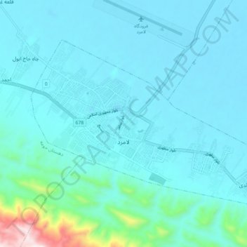
Name: Lamerd topographic map, elevation, terrain.
Location: Lamerd, بخش مرکزی, Lamerd County, Fars Province, Iran (27.31260 53.14847 27.36590 53.23674)
Average elevation: 476 m
Minimum elevation: 397 m
Maximum elevation: 1,119 m
Thank you for supporting this site ❤️
Make a donation
Make a donation
Gear up for your next adventure:
As an Amazon Associate, this site earns from qualifying purchases at no extra cost to you.