Geolocate

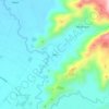
Namnama topographic map

Click on the map to display elevation.

About this map

Name: Namnama topographic map, elevation, terrain.

Location: Namnama, Koronadal, South Cotabato, Soccsksargen, Philippines (6.50145 124.84100 6.54328 124.87927)

Average elevation: 48 m

Minimum elevation: 33 m

Maximum elevation: 65 m

Other topographic maps

Click on a map to view its topography, its elevation and its terrain.
Quezon Range

Philippines > South Cotabato > Koronadal

Average elevation: 239 m

Quezon Range

Philippines > South Cotabato > Koronadal

Average elevation: 239 m

Siok

Philippines > South Cotabato > Koronadal > Mabini

Average elevation: 131 m

Gear up for your next adventure:

🗺️Topographic Maps - Detailed maps for hiking and navigation
🔋Rechargeable Batteries - Eco-friendly power for high-drain GPS units and flashlights
🥤Hydration Packs - Hydration systems for hiking
🥾Heavy Duty Hiking Boots - Ankle-supporting boots for carrying heavy packs on steep contours
🧴Sunscreen SPF - Sun protection for outdoor activities

As an Amazon Associate, this site earns from qualifying purchases at no extra cost to you.