
North Kansas City topographic map
Interactive map
Click on the map to display elevation.
About this map
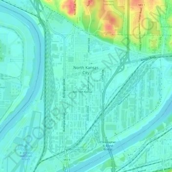
Name: North Kansas City topographic map, elevation, terrain.
Location: North Kansas City, Clay County, Missouri, VS (39.12308 -94.58683 39.15539 -94.53121)
Average elevation: 232 m
Minimum elevation: 218 m
Maximum elevation: 283 m