Geolocate

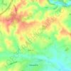
Newent topographic map

Click on the map to display elevation.

About this map

Name: Newent topographic map, elevation, terrain.

Location: Newent, Forest of Dean, Gloucestershire, England, United Kingdom (51.88396 -2.44646 51.96331 -2.34314)

Average elevation: 54 m

Minimum elevation: 8 m

Maximum elevation: 303 m

Other topographic maps

Click on a map to view its topography, its elevation and its terrain.
Gear up for your next adventure:

🧊Insulated Cooler Bags - Keep food fresh for day trips to remote geographic sites
🍳Ultralight Camping Stoves - Boil water quickly for meals using minimal fuel
📍Handheld GPS - GPS devices for hiking and navigation
🔋Solar Power Banks - Solar chargers for outdoors
🔦LED Torches - LED torches for outdoor use

As an Amazon Associate, this site earns from qualifying purchases at no extra cost to you.