Geolocate

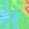
Natal topographic map

Click on the map to display elevation.

About this map

Name: Natal topographic map, elevation, terrain.

Location: Natal, Sparwood, Regional District of East Kootenay, British Columbia, V0B 2G0, Canada (49.71334 -114.87000 49.75334 -114.83000)

Average elevation: 1,394 m

Minimum elevation: 1,125 m

Maximum elevation: 2,013 m

Other topographic maps

Click on a map to view its topography, its elevation and its terrain.
Gear up for your next adventure:

🕶️Polarized Outdoor Sunglasses - Reduce glare from rocks and water for better visual navigation
🧢Outdoor Sun Hats - Sun protection hats for hiking
🧼Biodegradable Soap - Eco-friendly outdoor soap
🧊Insulated Stainless Steel Flasks - Keep water cold for 24 hours in the heat or coffee hot in the cold
🪫Rechargeable Headlamps - USB rechargeable headlamps

As an Amazon Associate, this site earns from qualifying purchases at no extra cost to you.