Geolocate

Bokajan topographic map

Click on the map to display elevation.

About this map
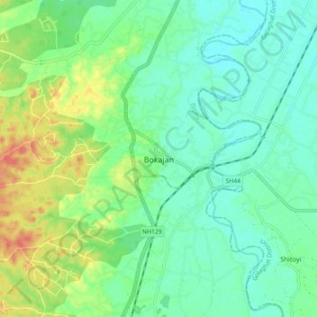
Name: Bokajan topographic map, elevation, terrain.

Location: Bokajan, Diphu, East Karbi Anglong, Assam, 782490, India (25.98351 93.73070 26.06351 93.81070)

Average elevation: 142 m

Minimum elevation: 124 m

Maximum elevation: 182 m

Gear up for your next adventure:

🔦Powerful LED Headlamps - Hands-free lighting for night navigation and setting up camp after dark
🧥Softshell Jackets - Flexible outdoor jackets
👣Snake & Scrub Gaiters - Protection against spinifex, mud, and snakes while walking off-track
🧴Sunscreen SPF - Sun protection for outdoor activities
🦟Insect Repellent - Protection against insects

As an Amazon Associate, this site earns from qualifying purchases at no extra cost to you.