
Cerroazul topographic map
Interactive map
Click on the map to display elevation.
About this map
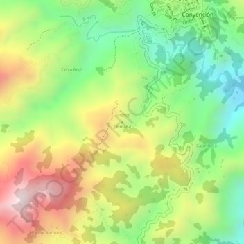
Name: Cerroazul topographic map, elevation, terrain.
Location: Cerroazul, Convención, Occidente, Norte de Santander, Colômbia (8.45426 -73.34473 8.45436 -73.34463)
Average elevation: 1,055 m
Minimum elevation: 800 m
Maximum elevation: 1,341 m