
Ashbourne topographic map
Click on the map to display elevation.
About this map
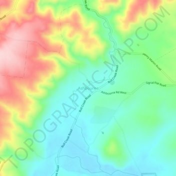
Name: Ashbourne topographic map, elevation, terrain.
Location: Ashbourne, Alexandrina Council, South Australia, Australia (-35.30736 138.74224 -35.26736 138.78224)
Average elevation: 197 m
Minimum elevation: 109 m
Maximum elevation: 350 m
Alexandrina Council trails, hiking, mountain biking, running and outdoor activities