Geolocate

Manaus topographic map

Click on the map to display elevation.

About this map
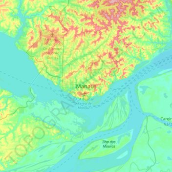
Name: Manaus topographic map, elevation, terrain.

Location: Manaus, Região Geográfica Imediata de Manaus, Região Geográfica Intermediária de Manaus, Amazonas, North Region, 69000-000, Brazil (-3.29163 -60.14250 -2.97163 -59.82250)

Average elevation: 33 m

Minimum elevation: 6 m

Maximum elevation: 118 m

Gear up for your next adventure:

🎒Ultralight Backpacks - Lightweight packs for long hikes
🧭Military Style Lensatic Compass - Durable sighting compasses for advanced land navigation and surveying
🗺️Topographic Maps - Detailed maps for hiking and navigation
🚁Camera Drones with GPS - Capture aerial views of the landscape to compare with topo maps
🎧Bluetooth Outdoor Earbuds - Listen to navigation cues or podcasts during long solo treks

As an Amazon Associate, this site earns from qualifying purchases at no extra cost to you.