
Bukhara topographic map
Interactive map
Click on the map to display elevation.
About this map
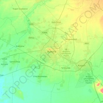
Name: Bukhara topographic map, elevation, terrain.
Location: Bukhara, Bukhara Region, 200100, Uzbekistan (39.60755 64.26313 39.92755 64.58313)
Average elevation: 221 m
Minimum elevation: 205 m
Maximum elevation: 256 m
About 140 miles (225 km) west of Samarkand in south-central Uzbekistan, Bukhara is located on the Zeravshan River, at an elevation of 751 feet (229 meters).