
Aljezur topographic map
Interactive map
Click on the map to display elevation.
About this map
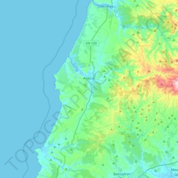
Name: Aljezur topographic map, elevation, terrain.
Location: Aljezur, Faro, Portugal (37.14947 -8.91822 37.44295 -8.67415)
Average elevation: 94 m
Minimum elevation: -1 m
Maximum elevation: 696 m
Other topographic maps
Click on a map to view its topography, its elevation and its terrain.