
東石鄉 topographic map
Interactive map
Click on the map to display elevation.
About this map
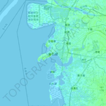
Name: 東石鄉 topographic map, elevation, terrain.
Location: 東石鄉, 嘉義縣, 臺灣省, 614, Taiwan (23.39582 120.10658 23.52288 120.22642)
Average elevation: 1 m
Minimum elevation: -2 m
Maximum elevation: 8 m