Geolocate

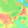
Ruawai topographic map

Click on the map to display elevation.

About this map

Name: Ruawai topographic map, elevation, terrain.

Location: Ruawai, Kaipara District, Northland, 0530, New Zealand (-36.15687 174.00528 -36.11687 174.04528)

Average elevation: 2 m

Minimum elevation: -1 m

Maximum elevation: 24 m

Other topographic maps

Click on a map to view its topography, its elevation and its terrain.

Wairoa River

New Zealand > Northland > Kaipara District

Average elevation: 42 m

Lake Kaiiwi

New Zealand > Northland > Kaipara District

Average elevation: 79 m

Lake Rototuna

New Zealand > Northland > Kaipara District

Average elevation: 120 m

Wairoa River

New Zealand > Northland > Kaipara District

Average elevation: 42 m

Gear up for your next adventure:

⌚GPS Watches - GPS watches for outdoor sports
👖Convertible Hiking Trousers - Zip-off legs to adapt to changing temperatures throughout the day
🌿Flora and Fauna Field Guides - Identify the plants and animals you encounter on your route
📍Handheld GPS - GPS devices for hiking and navigation
🪫Rechargeable Headlamps - USB rechargeable headlamps

As an Amazon Associate, this site earns from qualifying purchases at no extra cost to you.