Geolocate

Xunyang topographic map

Click on the map to display elevation.

About this map

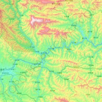
Name: Xunyang topographic map, elevation, terrain.

Location: Xunyang, Ankang, Shaanxi, China (32.48184 108.96515 33.21158 109.81274)

Average elevation: 780 m

Minimum elevation: 183 m

Maximum elevation: 2,310 m

Other topographic maps

Click on a map to view its topography, its elevation and its terrain.

Bahe

China > Shaanxi > Ankang

Average elevation: 591 m

Gear up for your next adventure:

🪑Portable Backpacking Chairs - A comfortable seat for studying maps at the end of the day
🗺️Topographic Maps - Detailed maps for hiking and navigation
🏕️Camping Gear - Essential camping equipment
🚴Bike GPS - GPS devices for cycling
📱Tablet Tripod Mounts - Steady platforms for viewing digital maps or taking long exposures

As an Amazon Associate, this site earns from qualifying purchases at no extra cost to you.