
Parceiros topographic map
Interactive map
Click on the map to display elevation.
About this map
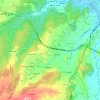
Name: Parceiros topographic map, elevation, terrain.
Location: Parceiros, Leiria, Portugal (39.70992 -8.87277 39.74518 -8.81779)
Average elevation: 87 m
Minimum elevation: 23 m
Maximum elevation: 193 m
Other topographic maps
Click on a map to view its topography, its elevation and its terrain.
Serra do Porto de Urso
Serra do Porto de Urso, Monte Real e Carvide, Leiria, 2425-047, Portugal
Average elevation: 39 m