
Mole River topographic map
Interactive map
Click on the map to display elevation.
About this map
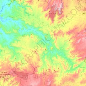
Name: Mole River topographic map, elevation, terrain.
Average elevation: 757 m
Minimum elevation: 362 m
Maximum elevation: 1,317 m
Other topographic maps
Click on a map to view its topography, its elevation and its terrain.
Tenterfield
Australia > New South Wales > Tenterfield
Tenterfield, Tenterfield Shire Council, New South Wales, Australia
Average elevation: 893 m