
Nazareth topographic map
Interactive map
Click on the map to display elevation.
About this map
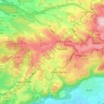
Name: Nazareth topographic map, elevation, terrain.
Location: Nazareth, Unterbezirk Jesreel, Nordbezirk, Israel (32.67277 35.26605 32.73630 35.31354)
Average elevation: 327 m
Minimum elevation: 104 m
Maximum elevation: 569 m
Other topographic maps
Click on a map to view its topography, its elevation and its terrain.