
Rossarden topographic map
Interactive map
Click on the map to display elevation.
About this map
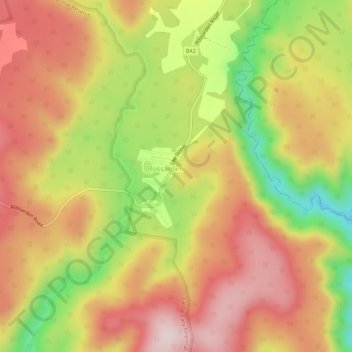
Name: Rossarden topographic map, elevation, terrain.
Location: Rossarden, Tasmania, Australia (-41.68809 147.72860 -41.64809 147.76860)
Average elevation: 648 m
Minimum elevation: 438 m
Maximum elevation: 803 m