Geolocate

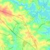
Westminster topographic map

Click on the map to display elevation.

About this map
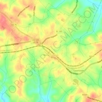
Name: Westminster topographic map, elevation, terrain.

Location: Westminster, Oconee County, South Carolina, United States (34.64914 -83.11404 34.68337 -83.06973)

Average elevation: 272 m

Minimum elevation: 235 m

Maximum elevation: 304 m

Other topographic maps

Click on a map to view its topography, its elevation and its terrain.
Phinney

United States > South Carolina > Oconee County

Average elevation: 270 m

Madison

United States > South Carolina > Oconee County

Average elevation: 240 m

Cheohee

United States > South Carolina > Oconee County

Average elevation: 339 m

Newry

United States > South Carolina > Oconee County

Average elevation: 251 m

Wexford

United States > South Carolina > Oconee County

Average elevation: 232 m

Dalton

United States > South Carolina > Oconee County > Seneca

Average elevation: 267 m

Gear up for your next adventure:

⛺Ultralight Solo Tents - Compact shelters for multi-day topographic surveying expeditions
👄SPF Lip Balm - Prevent sun and wind-burnt lips on mountain ridges
📡Weather Radios - Emergency weather radios
👣Snake & Scrub Gaiters - Protection against spinifex, mud, and snakes while walking off-track
🔌Fast Charging Adapters - Quickly top up all your gear before heading back into the field

As an Amazon Associate, this site earns from qualifying purchases at no extra cost to you.