
Frosinone topographic map
Interactive map
Click on the map to display elevation.
About this map
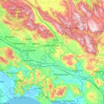
Name: Frosinone topographic map, elevation, terrain.
Location: Frosinone, Lazio, Italy (41.30135 12.99187 41.95513 14.02764)
Average elevation: 668 m
Minimum elevation: -3 m
Maximum elevation: 2,248 m
Other topographic maps
Click on a map to view its topography, its elevation and its terrain.