
Eddy County topographic map
Interactive map
Click on the map to display elevation.
About this map
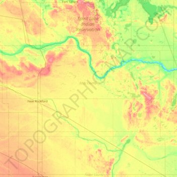
Name: Eddy County topographic map, elevation, terrain.
Location: Eddy County, North Dakota, United States (47.58664 -99.29746 47.84807 -98.50176)
Average elevation: 464 m
Minimum elevation: 417 m
Maximum elevation: 529 m
Other topographic maps
Click on a map to view its topography, its elevation and its terrain.
Fort Yates
United States > North Dakota > Sioux County > Fort Yates > Fort Yates
Average elevation: 499 m