
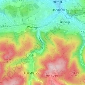
Westigerbach topographic map
Interactive map
Click on the map to display elevation.
About this map
Name: Westigerbach topographic map, elevation, terrain.
Average elevation: 328 m
Minimum elevation: 211 m
Maximum elevation: 485 m
Other topographic maps
Click on a map to view its topography, its elevation and its terrain.
Edelburg
Deutschland > Nordrhein-Westfalen > Märkischer Kreis > Hemer
Edelburg, Hemer, Märkischer Kreis, Nordrhein-Westfalen, 58706, Deutschland
Average elevation: 214 m
Grüntal
Deutschland > Nordrhein-Westfalen > Märkischer Kreis > Hemer > Grüntal
Grüntal, Hemer, Märkischer Kreis, Nordrhein-Westfalen, 58675, Deutschland
Average elevation: 345 m