
Curtin topographic map
Interactive map
Click on the map to display elevation.
About this map
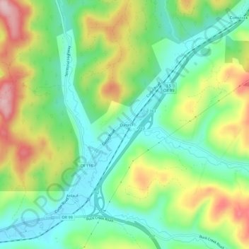
Name: Curtin topographic map, elevation, terrain.
Location: Curtin, Douglas County, Oregon, 97428, USA (43.70234 -123.23189 43.74234 -123.19189)
Average elevation: 192 m
Minimum elevation: 104 m
Maximum elevation: 341 m