
Council Grove Dam topographic map
Interactive map
Click on the map to display elevation.
About this map
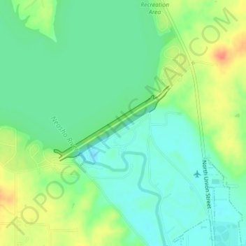
Name: Council Grove Dam topographic map, elevation, terrain.
Location: Council Grove Dam, Morris County, Kansas, USA (38.67706 -96.51004 38.68521 -96.49373)
Average elevation: 391 m
Minimum elevation: 373 m
Maximum elevation: 423 m
Other topographic maps
Click on a map to view its topography, its elevation and its terrain.