
Le Gosier topographic map
Interactive map
Click on the map to display elevation.
About this map
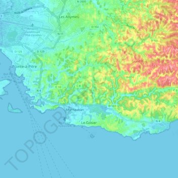
Name: Le Gosier topographic map, elevation, terrain.
Location: Le Gosier, Pointe-à-Pitre, Guadeloupe, 97190, France (16.19658 -61.53054 16.25813 -61.41964)
Average elevation: 25 m
Minimum elevation: -1 m
Maximum elevation: 117 m