Geolocate

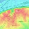
Ruskin topographic map

Click on the map to display elevation.

About this map

Name: Ruskin topographic map, elevation, terrain.

Location: Ruskin, Kansas City, Jackson County, Missouri, 64134, United States (38.90278 -94.53384 38.94278 -94.49384)

Average elevation: 302 m

Minimum elevation: 264 m

Maximum elevation: 323 m

Other topographic maps

Click on a map to view its topography, its elevation and its terrain.
Gear up for your next adventure:

🎽Base Layers - Thermal base layers
🔪Outdoor Multi-tools - Versatile tools for gear repair and survival tasks in the wilderness
🦘Outback Survival Gear - Essential gear for Australian outback
🩹Wilderness First Aid Kits - Comprehensive medical kits tailored for hiking and remote exploration
🧊Insulated Cooler Bags - Keep food fresh for day trips to remote geographic sites

As an Amazon Associate, this site earns from qualifying purchases at no extra cost to you.