
Newton Island topographic map
Interactive map
Click on the map to display elevation.
About this map
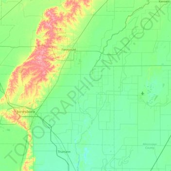
Name: Newton Island topographic map, elevation, terrain.
Location: Newton Island, Craighead County, Arkansas, USA (35.60257 -90.73871 36.24257 -90.09871)
Average elevation: 81 m
Minimum elevation: 59 m
Maximum elevation: 165 m
Other topographic maps
Click on a map to view its topography, its elevation and its terrain.
Ozark Plateau
Ozark Plateau, Coburn Loop, Clark County, Arkansas, USA
Average elevation: 51 m
New Blaine
USA > Arkansas > New Blaine
New Blaine, Logan County, Arkansas, 72851, USA
Average elevation: 132 m