
Cachicoto topographic map
Interactive map
Click on the map to display elevation.
About this map
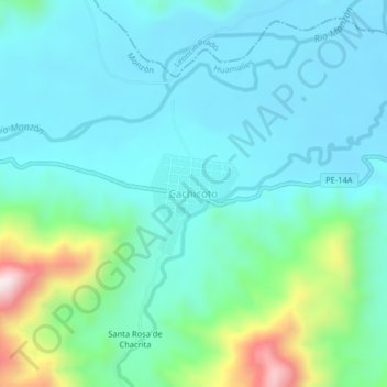
Name: Cachicoto topographic map, elevation, terrain.
Location: Cachicoto, Monzón, Huamalíes, Huánuco, Pérou (-9.23661 -76.23180 -9.19661 -76.19180)
Average elevation: 822 m
Minimum elevation: 715 m
Maximum elevation: 1,256 m
Other topographic maps
Click on a map to view its topography, its elevation and its terrain.