
Massy topographic map
Interactive map
Click on the map to display elevation.
About this map
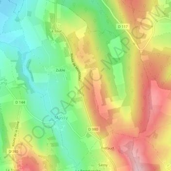
Name: Massy topographic map, elevation, terrain.
Average elevation: 304 m
Minimum elevation: 213 m
Maximum elevation: 407 m
Other topographic maps
Click on a map to view its topography, its elevation and its terrain.
La Berge
France > Bourgogne-Franche-Comté > Saône-et-Loire > La Vineuse sur Fregande
La Berge, Donzy-le-National, La Vineuse sur Fregande, Mâcon, Saône-et-Loire, Bourgogne-Franche-Comté, France métropolitaine, 71250, France
Average elevation: 321 m