
Kungsörs kommun topographic map
Interactive map
Click on the map to display elevation.
About this map
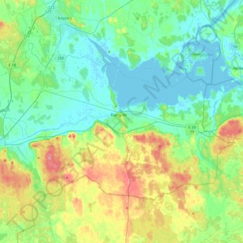
Name: Kungsörs kommun topographic map, elevation, terrain.
Location: Kungsörs kommun, Västmanland County, Sweden (59.34630 15.86769 59.49057 16.30646)
Average elevation: 24 m
Minimum elevation: -3 m
Maximum elevation: 84 m
Other topographic maps
Click on a map to view its topography, its elevation and its terrain.
Sala kommun
Sala kommun, Västmanland County, Sweden
Average elevation: 72 m