
Château de Digoine topographic map
Interactive map
Click on the map to display elevation.
About this map
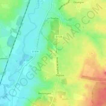
Name: Château de Digoine topographic map, elevation, terrain.
Average elevation: 272 m
Minimum elevation: 249 m
Maximum elevation: 303 m
Other topographic maps
Click on a map to view its topography, its elevation and its terrain.
Le Tilly
France > Bourgogne-Franche-Comté > Saint-Aubin-en-Charollais
Le Tilly, Saint-Aubin-en-Charollais, Charolles, Saône-et-Loire, Bourgogne-Franche-Comté, France métropolitaine, 71430, France
Average elevation: 273 m