
Kelheim topographic map
Interactive map
Click on the map to display elevation.
About this map
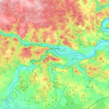
Name: Kelheim topographic map, elevation, terrain.
Location: Kelheim, Landkreis Kelheim, Bavaria, 93309, Germany (48.85376 11.71682 48.96464 12.01354)
Average elevation: 423 m
Minimum elevation: 334 m
Maximum elevation: 570 m
Other topographic maps
Click on a map to view its topography, its elevation and its terrain.