
Lenzerheide topographic map
Interactive map
Click on the map to display elevation.
About this map
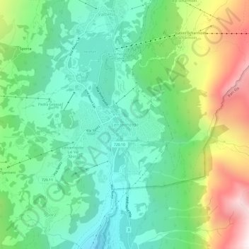
Name: Lenzerheide topographic map, elevation, terrain.
Location: Lenzerheide, Albula, Grauwbunderland, 7078, Zwitserland (46.70790 9.53683 46.74790 9.57683)
Average elevation: 1,709 m
Minimum elevation: 1,321 m
Maximum elevation: 2,525 m