Geolocate

Colgan topographic map

Click on the map to display elevation.

About this map
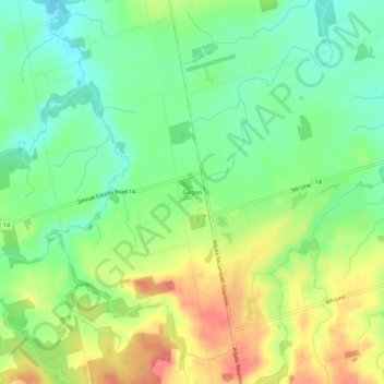
Name: Colgan topographic map, elevation, terrain.

Location: Colgan, Adjala–Tosorontio, Simcoe County, Central Ontario, Ontario, L0G 1W0, Canada (44.00871 -79.86875 44.04871 -79.82875)

Average elevation: 261 m

Minimum elevation: 231 m

Maximum elevation: 302 m

Other topographic maps

Click on a map to view its topography, its elevation and its terrain.

Gear up for your next adventure:

📡Weather Radios - Emergency weather radios
🧣Merino Neck Gaiters - Versatile headwear for warmth, sun protection, or dust filtering
🦯Trekking Poles - Walking poles for hiking stability
🧥Packable Rain Jackets - Breathable waterproof layers for unpredictable mountain weather
🔪Multitools - Compact tools for outdoor use

As an Amazon Associate, this site earns from qualifying purchases at no extra cost to you.