Geolocate

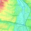
Brackenheim topographic map

Click on the map to display elevation.

About this map

Name: Brackenheim topographic map, elevation, terrain.

Location: Brackenheim, VVG der Stadt Brackenheim, Landkreis Heilbronn, Baden-Württemberg, 74336, Germany (49.04499 8.99035 49.11846 9.12576)

Average elevation: 230 m

Minimum elevation: 156 m

Maximum elevation: 388 m

Other topographic maps

Click on a map to view its topography, its elevation and its terrain.
Gear up for your next adventure:

🗺️Topographic Maps - Detailed maps for hiking and navigation
🆘Personal Locator Beacons (PLB) - Satellite emergency beacons for life-saving help in areas with no mobile coverage
🥤Hydration Packs - Hydration systems for hiking
🧭Compass - Navigation compasses for outdoor exploration
🎒Tactical Waist Packs - Quick access to your compass, phone, and snacks while walking

As an Amazon Associate, this site earns from qualifying purchases at no extra cost to you.