
Rock Springs topographic map
Interactive map
Click on the map to display elevation.
About this map
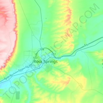
Name: Rock Springs topographic map, elevation, terrain.
Location: Rock Springs, Sweetwater County, Wyoming, 82901, VS (41.55951 -109.29124 41.64770 -109.04218)
Average elevation: 2,011 m
Minimum elevation: 1,887 m
Maximum elevation: 2,327 m