Geolocate

Providence Bay topographic map

Click on the map to display elevation.

About this map
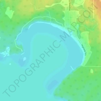
Name: Providence Bay topographic map, elevation, terrain.

Location: Providence Bay, Central Manitoulin, Manitoulin District, Northeastern Ontario, Ontario, P0P 1T0, Canada (45.66267 -82.27659 45.66277 -82.27649)

Average elevation: 180 m

Minimum elevation: 171 m

Maximum elevation: 199 m

Other topographic maps

Click on a map to view its topography, its elevation and its terrain.

Gear up for your next adventure:

🔥Windproof Plasma Lighters - USB rechargeable lighters that work in high-altitude winds
🧣Merino Neck Gaiters - Versatile headwear for warmth, sun protection, or dust filtering
🧦Hiking Socks - Comfortable socks for long hikes
👕UPF 50+ Sun Shirts - Essential protection against the harsh Australian sun during field work
🧦Merino Wool Hiking Socks - Moisture-wicking socks to prevent blisters during long topographic surveys

As an Amazon Associate, this site earns from qualifying purchases at no extra cost to you.