
岑巩县 topographic map
Interactive map
Click on the map to display elevation.
About this map
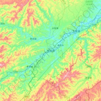
Name: 岑巩县 topographic map, elevation, terrain.
Location: 岑巩县, 黔东南苗族侗族自治州, 贵州省, 中国 (27.01688 108.65197 27.33688 108.97197)
Average elevation: 596 m
Minimum elevation: 340 m
Maximum elevation: 1,102 m