
Thank you for supporting this site ❤️
Make a donation
Make a donation
Gear up for your next adventure:
As an Amazon Associate, this site earns from qualifying purchases at no extra cost to you.
Icota topographic map
Click on the map to display elevation.
Thank you for supporting this site ❤️
Make a donation
Make a donation
Gear up for your next adventure:
As an Amazon Associate, this site earns from qualifying purchases at no extra cost to you.
About this map
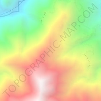
Name: Icota topographic map, elevation, terrain.
Location: Icota, Chitagá, Suroccidente, Norte de Santander, Colombia (7.22139 -72.60502 7.24139 -72.58502)
Average elevation: 2,402 m
Minimum elevation: 1,757 m
Maximum elevation: 2,960 m
Thank you for supporting this site ❤️
Make a donation
Make a donation
Gear up for your next adventure:
As an Amazon Associate, this site earns from qualifying purchases at no extra cost to you.