
Pulau Laut topographic map
Interactive map
Click on the map to display elevation.
About this map
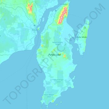
Name: Pulau Laut topographic map, elevation, terrain.
Location: Pulau Laut, Kotabaru, South Kalimantan, Indonesia (-4.08541 116.00295 -3.20991 116.33889)
Average elevation: 13 m
Minimum elevation: -4 m
Maximum elevation: 696 m