Geolocate

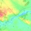
Colton Lake topographic map

Click on the map to display elevation.

About this map

Name: Colton Lake topographic map, elevation, terrain.

Location: Colton Lake, Admaston/Bromley, Renfrew County, Eastern Ontario, Ontario, Canada (45.42878 -76.85275 45.44652 -76.84056)

Average elevation: 179 m

Minimum elevation: 160 m

Maximum elevation: 223 m

Other topographic maps

Click on a map to view its topography, its elevation and its terrain.
Douglas

Canada > Ontario > Renfrew County > Admaston/Bromley

Average elevation: 148 m

Gear up for your next adventure:

🩹First Aid Kits - Emergency kits for hiking
🧦Merino Wool Hiking Socks - Moisture-wicking socks to prevent blisters during long topographic surveys
👟Lightweight Trail Runners - Agile footwear for fast movement over rugged Australian terrain
🧣Merino Neck Gaiters - Versatile headwear for warmth, sun protection, or dust filtering
🔥Camping Stoves - Portable stoves for outdoor cooking

As an Amazon Associate, this site earns from qualifying purchases at no extra cost to you.