
신촌동 topographic map
Interactive map
Click on the map to display elevation.
About this map
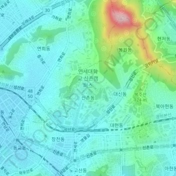
Name: 신촌동 topographic map, elevation, terrain.
Location: 신촌동, 서대문구, Corea del Sur (37.55508 126.92662 37.57739 126.95187)
Average elevation: 66 m
Minimum elevation: 14 m
Maximum elevation: 281 m