
Limal topographic map
Interactive map
Click on the map to display elevation.
About this map
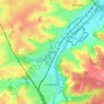
Name: Limal topographic map, elevation, terrain.
Location: Limal, Nivelles, Brabant wallon, Wallonie, 1302, Belgique (50.67307 4.55363 50.71307 4.59363)
Average elevation: 83 m
Minimum elevation: 43 m
Maximum elevation: 132 m