Geolocate

Fishtoft topographic map

Click on the map to display elevation.

About this map
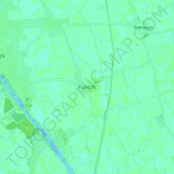
Name: Fishtoft topographic map, elevation, terrain.

Location: Fishtoft, Boston, Lincolnshire, Greater Lincolnshire, England, PE21 0RS, United Kingdom (52.94188 0.00690 52.98188 0.04690)

Average elevation: 4 m

Minimum elevation: -1 m

Maximum elevation: 9 m

Other topographic maps

Click on a map to view its topography, its elevation and its terrain.

Boston

United Kingdom > England > Lincolnshire > Boston

Average elevation: 4 m

Kirton CP

United Kingdom > England > Lincolnshire > Boston

Average elevation: 4 m

Gear up for your next adventure:

🔋Rechargeable Batteries - Eco-friendly power for high-drain GPS units and flashlights
📦Crushproof Equipment Cases - Safe transport for sensitive surveying and mapping instruments
🔪Camping Knives - Multi-purpose outdoor knives
⌚GPS Watches - GPS watches for outdoor sports
🐍Australian Snake Bite Kits - Specific pressure immobilization bandages for Australian venomous snakes

As an Amazon Associate, this site earns from qualifying purchases at no extra cost to you.