Geolocate

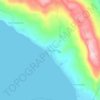
Manapao topographic map

Click on the map to display elevation.

About this map

Name: Manapao topographic map, elevation, terrain.

Location: Manapao, Minalabac, Camarines Sur, Bicol Region, Philippines (13.53732 123.21367 13.56784 123.25155)

Average elevation: 14 m

Minimum elevation: 5 m

Maximum elevation: 29 m

Other topographic maps

Click on a map to view its topography, its elevation and its terrain.

Antipolo

Philippines > Camarines Sur > Minalabac

Average elevation: 23 m

Salingogon

Philippines > Camarines Sur > Minalabac

Average elevation: 77 m

Gear up for your next adventure:

🥾Trail Running Shoes - Shoes for trail running
👕UPF 50+ Sun Shirts - Essential protection against the harsh Australian sun during field work
🎽Hiking Clothing - Breathable clothing for hiking
🧤Thermal Hiking Gloves - Keep your hands warm and functional during high-altitude winter treks
🆘Personal Locator Beacons (PLB) - Satellite emergency beacons for life-saving help in areas with no mobile coverage

As an Amazon Associate, this site earns from qualifying purchases at no extra cost to you.