
Ustroń topographic map
Interactive map
Click on the map to display elevation.
About this map
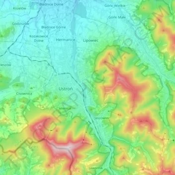
Name: Ustroń topographic map, elevation, terrain.
Location: Ustroń, powiat cieszyński, Silésie, 43-450, Pologne (49.66166 18.76027 49.77550 18.90239)
Average elevation: 486 m
Minimum elevation: 302 m
Maximum elevation: 981 m