Geolocate

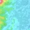
Riwaka topographic map

Click on the map to display elevation.

About this map

Name: Riwaka topographic map, elevation, terrain.

Location: Riwaka, Tasman District, Tasman, 7198, New Zealand (-41.10024 172.97678 -41.06024 173.01678)

Average elevation: 10 m

Minimum elevation: -1 m

Maximum elevation: 153 m

Other topographic maps

Click on a map to view its topography, its elevation and its terrain.

Maruia River

New Zealand > Tasman > Tasman District

Average elevation: 761 m

Tākaka River

New Zealand > Tasman > Tasman District

Average elevation: 611 m

Motueka River

New Zealand > Tasman > Tasman District

Average elevation: 538 m

Brown River

New Zealand > Tasman > Tasman District

The source of the Brown River is near Brown Hill (elevation 1,104 metres or 3,622 feet) and the river flows north from the ridgeline adjacent to this hill. The Heaphy Track is on the south side of that ridgeline, with the river's source roughly halfway between Aorere Shelter and Flanagans Corner (the track's…

Average elevation: 625 m
Saddle Creek

New Zealand > Tasman > Tasman District

Average elevation: 853 m

Motueka River

New Zealand > Tasman > Tasman District > Motueka

Average elevation: 66 m

Gear up for your next adventure:

🥤Hydration Packs - Hydration systems for hiking
⌛Survival Blankets - Emergency thermal blankets
🥾Hiking Shoes - Lightweight hiking shoes for day hikes
🔋Solar Power Banks - Charge your phone and GPS using the sun while deep in the bush
🧺Fast-Dry Microfiber Towels - Large towels that pack down to the size of an orange

As an Amazon Associate, this site earns from qualifying purchases at no extra cost to you.